

Sub-Meter Spatial Intelligence
PT Pratama Persada Airborne delivers engineering-grade geospatial solutions across Southeast Asia, translating complex physical terrain into highly accurate, structured GIS datasets.
Engineering-Grade Accuracy
19.3M Ha
Surveyed terrain
± 0.75 m
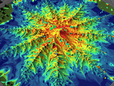
DSM/DTM precision
21
Completed tenders
4.7 / 5.0
Client satisfaction
Our Core Values
Professional
Innovative
Responsible
We execute nationwide large-scale geospatial mapping with rigorous engineering standards, ensuring every dataset meets strict accuracy thresholds.
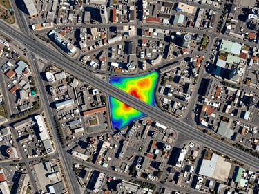
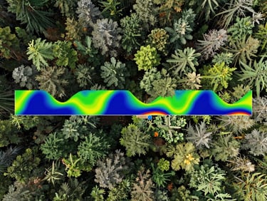
Deploying advanced sensors like the Leica Terrain Mapper 1 to penetrate dense jungle canopy and capture high-resolution elevation data.
We deliver certified, legally compliant spatial information that de-risks critical infrastructure and forestry decisions.
SBU Registration
Official Business Entity Certificates for high-precision topographic, LiDAR, and photogrammetric surveys across Indonesia.
Certified Enterprise Mapping
PP Airborne is a certified member of PERKINDO and holds official SBU certificates for non-consulting and construction services, authorizing nationwide geospatial intelligence operations.
PERKINDO Membership
Active member in good standing, adhering to national engineering-grade accuracy and professional geospatial standards.