Delivering High-Precision Spatial Intelligence
Sub-meter engineering-grade mapping solutions across Southeast Asia. We translate complex physical terrain into structured, actionable GIS datasets.
Engineering-Grade Surveying Solutions
Aerial Photogrammetric Survey
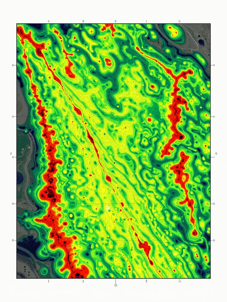
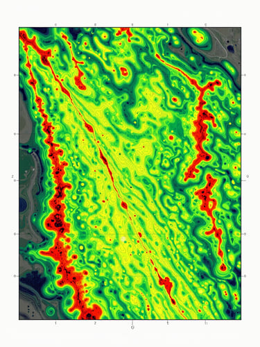
Active Sensor Terrain Modeling
Topographic Survey & GIS
We deliver high-resolution orthophoto mapping tailored for urban planning, rural zoning, and large-scale infrastructure corridors across Indonesia.
Our laser-based terrain modeling utilizes the proprietary Leica Terrain Mapper 1 system to achieve deep forest canopy penetration and highly accurate bare-earth models.
We provide high-precision ground control measurements and advanced GIS spatial analysis, preparing structured data layers ready for immediate engineering deployment.
Sub-Meter Precision Standards
Our airborne sensors capture physical geography with rigorous engineering-grade accuracy, delivering reliable foundation data for critical infrastructure.
Orthophoto Mapping
Digital Surface Models
Digital Terrain Models
We generate high-resolution imagery mapped to absolute coordinate systems, ensuring ground sampling distance is tailored to your exact engineering requirements.
Our models capture both natural and built features of the environment, providing essential datasets for telecommunications, obstruction mapping, and forestry canopy analysis.
We process bare-earth elevation data by filtering out dense vegetation and man-made structures, delivering crucial basemaps for hydrological modeling and civil engineering.
± 0.75 m
Horizontal Accuracy
± 0.75 m
Vertical Accuracy
± 0.75 m
Bare-Earth Accuracy
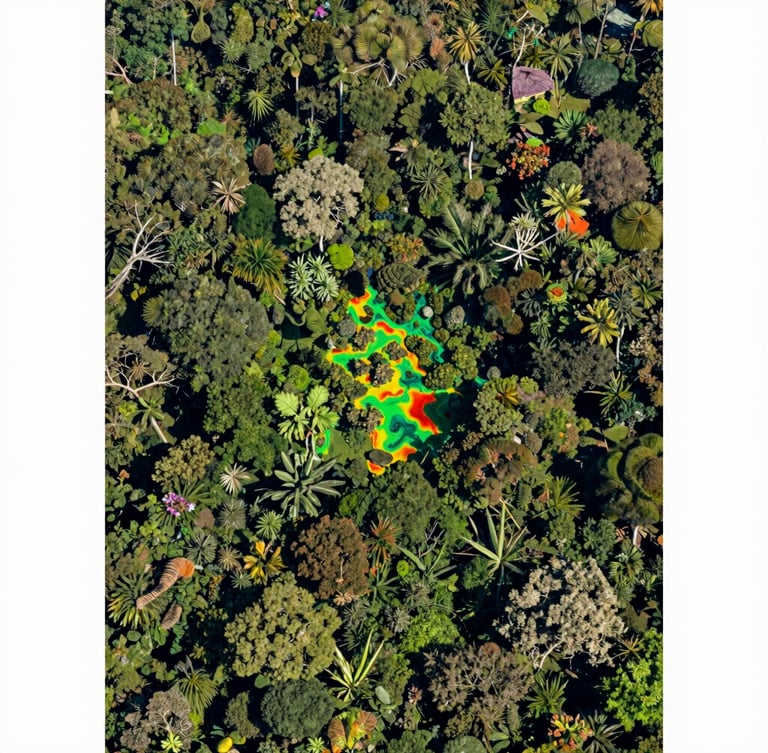
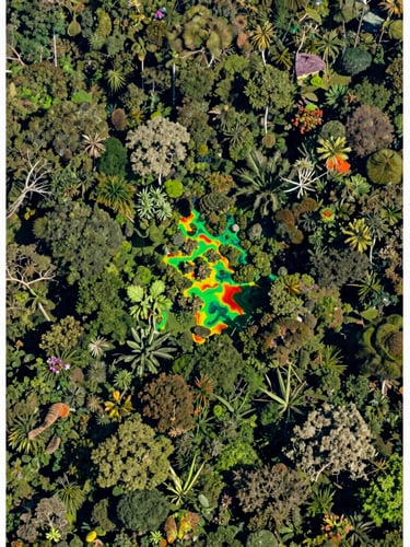
Advanced NDVI Vegetation Mapping
We utilize Red and Near-Infrared spectral reflectance curves to monitor crop vigor, forest health, and regional deforestation trends.
By analyzing how plant canopies interact with solar radiation, our GIS systems deliver precise metrics on biomass density and vegetation stress across millions of hectares.
Ready to Map Your Next Corridor?
Get in touch with our technical team in Jakarta to discuss accuracy requirements, sensor deployment, and project scheduling.